Low-Cost LiDAR for Geodetic Monitoring: Errors, Limitations and Capabilities
Workshop Description:
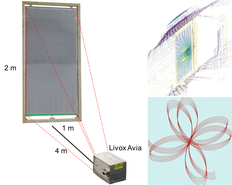
The tutorial deals with the topic of whether low-cost LiDAR (Light Detection and Ranging) can also be used for the deformation analysis of built structures. At first, we analyze the characteristics and uncertainty of measured point clouds based on self-performed scans. Afterwards, we look at whether geometric changes of measured structures can potentially be quantified from the point clouds. All in all, we address the following questions:
- How do the measurement technology and the resulting point clouds differ between high-end TLS and low-cost LiDAR?
- What are accuracy-limiting effects of low-cost LiDAR?
- For what kind of monitoring tasks could a low-cost LiDAR be suitable?
After a methodological introduction, participants will have the opportunity to generate point clouds of different objects with high-end TLS and low-cost LiDAR. Using freely available software packages, these point clouds are then processed independently to identify error patterns or synthetically induced deformations. In the end, we interpret and conclude the results in a final discussion.
Organizers:
- Prof. Dr.-Ing. Christoph Holst
- Omar AbdelGafar, M.Sc.
- Jakob Hummelsberger, M.Sc.
Target Group and Requirements:
The tutorial is primarily aimed at people who have already gained experience with high-end terrestrial laser scanners. The evaluations are carried out in common software (presumably Cloud Compare). No programming knowledge is required. Low-cost Livox Avia LiDARs are used to carry out the low-cost scans. The measurements and evaluations take place in groups of up to 3 students.
Teaching form and data base:
The workshop will start with a general introduction to the topic including a lecture. This will be followed by practical exercises based on data acquisition and processing using freely available software.