Generating High-End Points Clouds – From Data Acquisition to Quality Assurance
Workshop Description:
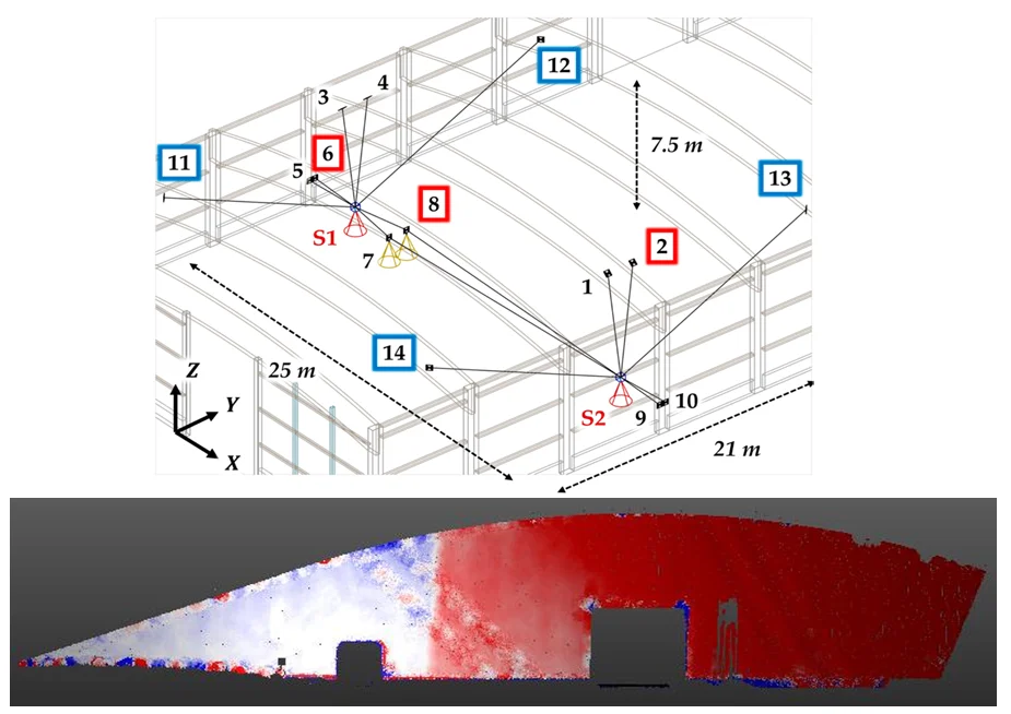
To perform deformation analysis using TLS (terrestrial laser scanners), it is essential to generate highly accurate point clouds and to ensure their quality. This workshop focuses on the creation of a high-end point cloud of a concrete wall and on carrying out calibration measurements. The key questions are:
- Which measurement geometry should be selected to achieve the highest possible accuracy?
- How can high-quality georeferencing be ensured?
- How can systematic effects, particularly those caused by internal misalignments of the TLS, be reduced?
After an introduction to systematic influences on point clouds, particularly those arising from internal misalignments of the instrument, participants will independently create a georeferenced, high-end point cloud of a concrete wall from multiple scanner positions. In addition, calibration measurements will be carried out in a dedicated calibration field to correct the acquired point clouds. Using a provided reference geometry of the measured object, the impact of the calibration will be analyzed in order to draw conclusions about the quality of the final point cloud.
Organizers:
- Prof. Dr.-Ing. Heiner Kuhlman
- Eike Koller, M.Sc.
Target Group and Requirements :
The workshop is primarily aimed at participants who already have initial experience with TLS. Data processing is carried out using both common commercial software provided by scanner manufacturers and freely available software (CloudCompare). Calibration is performed in MATLAB; however, no programming skills are required. The scans are acquired using TLS instruments from Leica and Zoller + Fröhlich.